Home > Solution > 3D Spatial Information Management
Summary
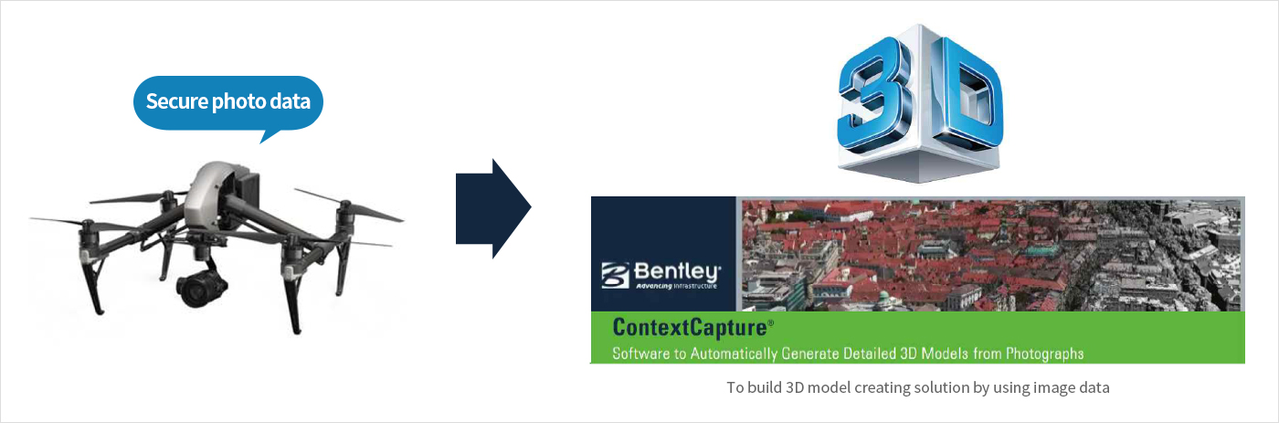
We make broadband three-dimensional models, manage the changes on objects and do three-dimensional simulation by using Drone and ContextCapture(3D embodied solution), which enables visually effective management for the objects.
System Configuration
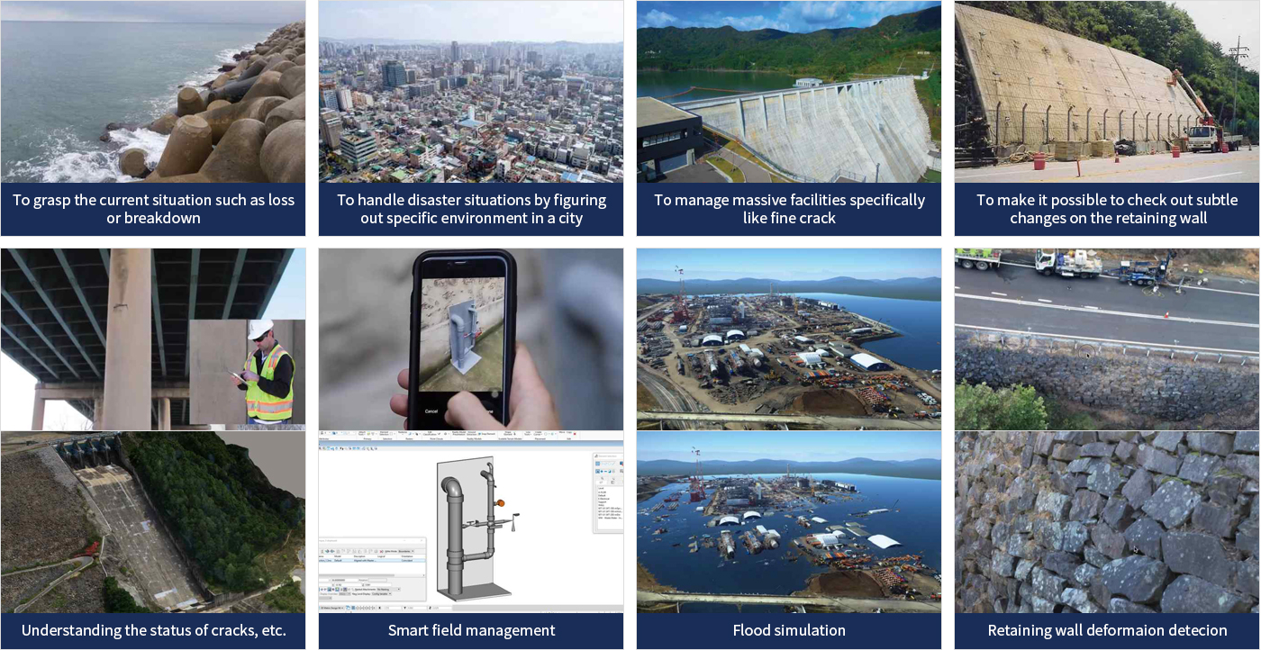
We can also provide comparative analysis of detailed change on objects through 3D model and figure out specific environment virtually so that it's available in disaster situations such as fire or flood.